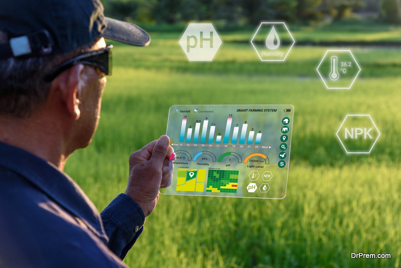
An essential part of modern agriculture is the monitoring of crop conditions with the help of technology. And that is what agritech, the future of farming technology is for. Years ago, when technology was not available yet, farmers have sown and reaped crops relying on ancient seasonal patterns, using traditional knowledge for preventing droughts and floods that could be a threat. To check on crops’ health, they had to inspect their fields by foot and detect any changes themselves. Till this day, there are a number of obstacles they face:
- There is no complete picture of the whole field
- Getting to the fields in bad weather
- Plants height not allowing to get deeper into the field or inspect the whole plant from top to bottom
Luckily, modern farming technology offers many ways to monitor crops throughout the growing season much easier. Let’s take a look at the most popular of those.
Satellite Monitoring in Farming

Satellite monitoring is a future of farming technology that offers endless opportunities for the future of agriculture. It allows online monitoring of any changes in the field based on vegetation indices, the most common being the NDVI (Normalized Difference Vegetation Index). NDVI values are obtained via the spectral analysis of high-resolution satellite images. This technology is a part of precision farming methods, since the difference in dynamics of the vegetation index indicates the disproportion in crop development stages. This allows making an effective decision on the need for additional agricultural work, assessong germination, growth, the presence of weeds or diseases, as well as predicting fields productivity.
The index readings are generated through satellite imagery of a green mass, which absorbs electromagnetic waves in the visible red range and reflects them in the near infrared. The larger the leaf surface of the plants and the more chlorophyll (green pigment in leaves), the more the plants absorb the red light and reflect it less. In result, farmers get a full-fledged spectral analysis and can easily identify zones of the field that need watering, fertilizers, or pest management.
NDVI value varies throughout the plant growth period, being at its highest at the beginning of the growing season and at the lowest during ripening. Depending on soil fertility, meteorological conditions, and crop cultivation technology, the rate of biomass development will also be different.
Having the NDVI analysis, all farmers have to do is observe their crops during the entire growing season, remotely identifying all deviations, based on the data available on any convenient device. Growing with such a technology, agrarians today can enjoy cost-effective and highly accurate ways to manage their crops.
But where do they get access to satellite fields data with analyzed vegetation indices? The answer is a variety of products that offer different features for field management. One of those is EOS Crop Monitoring.
Crop Monitoring to Access to Latest Farming Technologies
According to Forbes article, farmers are in need of modern technology to predict and prevent threats to millions of acres of crops worldwide. And Crop Monitoring is exactly a tool and the future of farming technology for helping with that via offering the following options.
Satellite Monitoring
Satellite field monitoring allows farmers to manage their crops online, from home or the office. Besides, they get email notifications if there are any changes in the state of crops so that they can take appropriate measures in a timely manner. Field data is available in one screen for convenience, allowing for saving money and resources on field management.
Weather Data
 This feature is for the farmers to follow the weather patterns for their fields to detect their impact on crops health and make accurate decisions on different activities, including sowing time and irrigation. Weather data is updated daily and shows temperatures, wind, clouds, precipitation, and humidity, allowing for weather risks analysis.
There is also a historical 5-year weather archive for the farmers to analyze the weather in their region and make predictions accordingly. With access to all this weather data, farmers are able to prevent yield losses that may occur due to weather stresses.
Field Leaderbord
This feature allows users to sort their fields by productivity. That is done by automatic analysis of the field based on 9 different criteria. Besides, users receive notifications about any critical NDVI changes (new image + index value) and can download already structured field productivity data as a spreadsheet.
Zoning
 This feature offers users an accurate outlook on the field’s precise needs, based on the NDVI values in different field zones. That is to help with fertilizers application and drip irrigation management in the most efficient way. It allows saving resources and budget, increasing the crop yield and revenue via preventing overapplication of water, fertilizers, or pesticides.
Scouting
Scouting feature allows farmers, traders, and insurers to create, share, and monitor scouting tasks remotely, based on the detected changes in a particular zone of the field. That is for saving tons of time and effort while also reducing costs on human resources.
Farming technologies of the future simplify and improve agrarians work every day. Satellite monitoring is becoming more and more common, revolutionizing farming practices. It goes to show how progress leads to more convenience and higher revenues, allowing to simplify manual processes and increase productivity.
Article Submitted By Community Writer